Participatory 3D Modelling in Mt Talinis and Twin Lakes sets the foundations for an award winning initiative
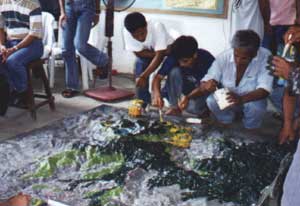
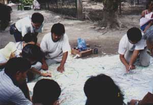
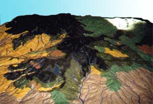
 This 1:20,000 scale model Community-made 3-D Model of Mt. Talinis and Twin Lakes, Valencia, Sibulan and San Jose Negros Oriental, Philippines was completed in year 1999. It covers an area of 1,800 sq km and has been produced by representatives from eight People’s Organizations, Local Government Units and Line Agencies in the framework of the Foundation for the Philippine Environment (FPE) funded “Mt. Talinis and Twin Lakes Biodiversity Conservation Project” (1996-1999). Facilitation and technical assistance has been provided by the Center for Tropical Conservation Studies (CENTROP).
 In November 2000, the Twin Lakes area was proclaimed a national park by virtue of Presidential Proclamation No. 414. The area was to fall under the jurisdiction of the Department of Environment and Natural Resources. Through the Mt Talinis and Twin Lakes Biodiversity Conservation project, the peoples’ organizations were quick to begin lobbying efforts, including successful provision of a wildlife hunting ordinance, which banned the hunting of certain threatened species and provided for associated penalties for violators. The groups also turned their attention to the development of an Area Management Framework Plan, which would outline policies for the management of the 15,287-hectare area and delineate land use zones, including a ‘strict protection zone’
 Pederasyon sa Nagkahiusang mga Mag-uuma nga Nanalipud ug Nagpasig-uli sa Kinaiyahan (PENAGMANNAK) is a federation of seventeen peoples’ organizations – self-help groups or cooperatives – working to conserve biodiversity in the Mt. Talinis area of Negro Oriental province. With their roots in the Mt. Talinis and Twin Lakes Biodiversity Conservation project (1996-1999), these groups’ early activities included communal tree-farming and environmental awareness-raising.
Since the Mt. Talinis-Twin Lakes area gained protected status in 2000, the groups’ work has focused on the development of an area management plan, which has outlined policies for the management of the 15,287-hectare area and delineated land use zones. The role of the federation has been to improve the management capacity of these groups, and to facilitate the development of sustainable livelihoods through including micro-lending, livestock dispersal, and organic fertilizer production, among other activities. In 2006, PENAGMANNAK was awarded the UNDP Equator prize.

Follow us!