Participatory 3D Modelling of Mount Banahaw National Park, Quezon Province, Philippines
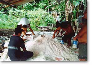
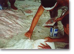 The 1:5,000 scale 3D model of Mt. Banahaw National Park, Quezon Province , Region IV, Philippines was completed in year 2001. The NGO Luntiang Alyansa ng Bundok Banahaw (LABB) or Mt. Banahaw Green Alliance advocates and implements community-based protection and sustainable natural resource management for the Mt. Banahaw mountain complex. Philippine Association for Intercultural Development (PAFID) assisted LABB and members from the local community in preparing a 3-D model of the area to be used as a tool for increasing local capacity in land use planning and resource protection.
Participatory 3D Modelling (P3DM) was used in combination with geographic Information Systems (GIS) technology made available by PAFID. The model has been used for a number of activities including: (i) redefinition of the boundary of the national park, (ii) community-based planning land use, (iii) organizing village groups to protect the protected area, (iv) awareness raising, and (v) preparing a patrolling plan.
Model produced by Luntiang Alyansa ng Bundok Banahaw (LABB) or Mt. Banahaw Green Alliance with technical assistance provided by PAFID and financial support by the Foundation For Philippine Environment (FPE).
Follow us!