Participatory 3D Model of the Godawari and Manedobhan Watersheds in Godawari and Tripeni, Nepal
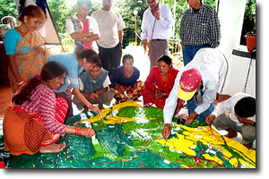
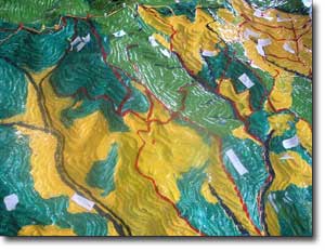 This 1:2,500-scale 3-D model of Godawari and Manedobhan Watersheds (including Phulchoki Peak) in Godawari and Tripeni, Nepal has been completed in September 2003. On the model lowest and highest elevations are 1,455 m a.s.l. and 2,765 m. a.s.l. respectively. The total area covered correspond to 26 sq. km. The model has been manufactured in the context of a training on Participatory Three Dimensional Modelling (P3DM) organized by the International Centre for Integrated Mountain Development (ICIMOD) and facilitated by PAFID from 23 to 30 September 2003 at the ICIMOD Training Centre in Godavari, Nepal. The activity benefitted from funding provided by the International Fund for Agricultural Development (IFAD) and was later on replicated within activities conducted by the Mountain Environment and Natural Resources Information Systems (MENRIS)
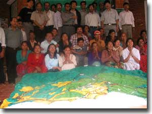 According to the facilitators, the 3D Model has been helpful to communicate with communities having limited knowledge about maps and geographic information systems. The Tamang community used the 3D model to update ICIMOD spatial data on land-uses and forest management systems. Participants included 24 representatives from different village community groups and 22 from national and international organizations.
Follow us!