Participatory 3D Model of the Higaonon and Talaandig Peoples’ Ancestral Domain Claim

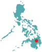 This 1:5,000-scale 3D model representing a total area of 288 km2 claimed by the Higaonon and Talaandig Indigenous Peoples as their ancestral domain, was completed in year 2000 in Pangantucan, Bukidnon, Philippines.
The model has been instrumental – among others – in gathering evidence supporting ownership of the ancestral domain, resolving boundary conflicts, delineating boundaries, filing the CADC/CADT applications and preparing the Ancestral Domain Management Plan required by the Philippines law.
As the second largest island in the Philippine archipelago, Mindanao covers a third of the country’s land resources. It is home to a quarter of the nation’s indigenous or lumad peoples, who are rapidly losing their land and its natural resources to warlords and the island’s economic elite.
A project known as “Mapping the ancestral domains of the indigenous peoples in Mindanao” was carried out by the Philippine Association for Intercultural Development (PAFID). Its objective was to set up to secure the land tenure rights of the indigenous communities over their ancestral domains. The passage of the IPRA Indigenous Peoples Rights Act (IPRA, Republic Act No. 8371) has provided the legal backbone to achieve this. Mapping and delineation of ancestral domains consisted in a highly participatory process, involving on-ground surveys utilizing both traditional methods and state-of-the-art technology such as the Global Positioning System (GPS). The involves also the manufacture of scaled 3D models of the ancestral domains by community members, enabling them to easily grasp the basic concepts of spatial, biophysical analysis in determining the current resource base and boundaries of their ancestral domain.
Follow us!