Participatory 3D Model of the municipality and indigenous lands in Mozonte, Nicaragua
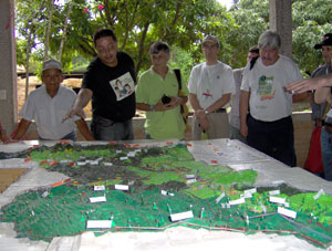
 This 3D model was completed in 2007. At a 1:10,000 scale it covers a total area of 396 km2 within the Municipality of Mozonte, including indigenous lands.
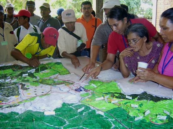
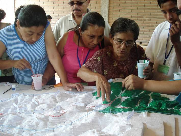
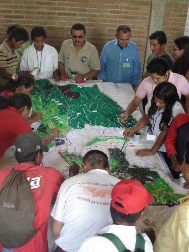
The exercise took place in order to promote a dialogue between indigenous and municipal authorities and other stakeholders on land management and train stakeholders in the use of Participatory 3D modelling (P3DM) for educational (students), promotional (rural tourism) and governance (local authorities) purposes.
Participants in the exercise included Indigenous People of Mozonte, the mayor of Mozonte, producers, local representatives from ministries, community animators, children, youth, Council of Elders, and NGOs
As a result of the exercise the boundary stones demarcating indigenous territory were made public as among the particiopants one elder knew the location of all landmarks. On the other hand the youth knew only a few. The process and the vislalisation of all the cornerstones facilitated addressing boundary conflicts.
 In Nicaragua, there is an overlap of rights that affects the possibilities of sustainable use of natural resources. In Mozonte, there were standing conflicts between the indigenous and the municipal authorities as both entities have their own boundary outlines. Indigenous people rely on cornerstones known to the elders only and the local administration relies on boundaries drawn on paper by the Government.
The models has been produced by the following institutions: Agrónomos y Veterinarios Sin Fronteras Nicaragua, Unión Nacional de Agricultores y Ganaderos (UNAG) del departamento de Nueva Segovia (Nicaragua) y Pueblo Indígena de Mozonte.
Supporting agencies: European Union, Ministerio de Asuntos Exteriores de Francia, Fundación Provictimis
Recommended readings:
___________ 2010. Mapeo Participativo y Resolución de conflictos de tierra en Telpaneca. Equipo Técnico-UNAG Nueva Segovia, Pueblo Indígena de Telpaneca y Agrónomos y Veterinarios Sin Fronteras. Ruta de Aprendizaje Experiencias innovadoras en cartografía participativa y empoderamiento legal en Centroamérica. ILC-Procasur
Noémi Gonda and Denis Pommier [et al.] 2004. Prevención y resolución de conflictos en torno a la tierra y los recursos naturales: manual práctico de mapeo comunitario y uso del GPS para organizaciones locales de desarrollo .– 1a ed.– Managua: Unión Europea, 2004, 90 p.
Gonda, N.; and Pommier, D. 2008. Herramientas para la Gestión Social del Territorio y de los Recursos Naturales: Metodologia Participativa para Construir una Maqueta de su Territorio. Managua: Unión Europea (European Union) (57p.)
Video Productions:
Location map:
Follow us!