Participatory 3D Modelling for Participatory Land Use Planning (PLUP) in West Garo Hills, India
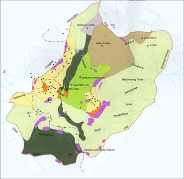
 This 1:5,000-scale model of the West Garo Hills, Tura and Sasatgre, Meghalaya was completed in 2003 in India. At the time of the “North Eastern Region Community Resource Management Project for Upland Areas Project” (NERCRMP) implementation, land tenure was extremely complex in the area. The traditional clan controlled-system, which secured subsistence cultivation rights and access to forest produce, had been rapidly eroding. The uncertainty of long-term access to land, or the ownership status, was one of the major limiting factors when a farmer or a community made decisions on land use and long-term investments.
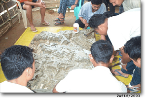
In May 2003, within the context of the North Eastern Region Community Resource Management Project for Upland Areas Project (NERCRMP), the West Garo Hills Community Resource Management Society (WGRHCRMS) hosted a training on P3DM facilitated by Philippine Association for Intercultural Development (PAFID), a Filipino NGO. The event was supported by the International Fund for Agricultural Development (IFAD) and the International Centre for Integrated Mountain Development (ICIMOD).
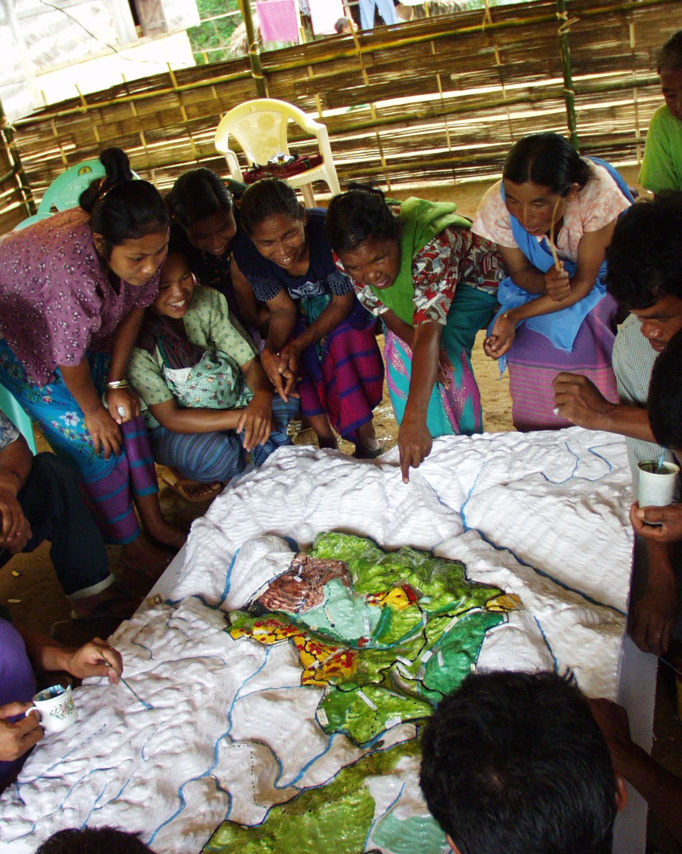
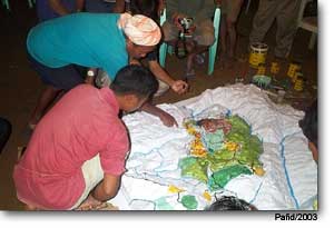
“Sasatgre residents received their guests with a song that thanked their forebears for taking care of the traditional lands, or akhing. Many community members from Sasatgre as well as the nearby song of Sakaladuma helped in depicting land use on the model. Nokmas, or traditional leaders of the akhings, from adjoining villages also helped the Sasatgre nokma to identify the boundaries of the Sasatgre akhing on the 3D model.” “It is crucial to understand that land use management, particularly optimization of land use is essential if pressure on forests (and hence, on biodiversity and other natural resources) is to be arrested and subsequently reversed. In NERCRMP, we realized that given the marginalization of shifting cultivation, we need to gradually sedentarise agriculture so that the pressures on resources can be reduced. It is absolutely critical that food grains – staples as well as vegetables are be grown on a rotational basis on permanent plots. In the existing context permanent farming need the development of terraces based on the identification of suitable land (slope, soil quality, water availability). For this purpose, P3DM was found to have the most potential. It helped establishing a transparent and participatory process of site identification, hence, everyone in the village was ensured access to terraces. It also helped selection of sites in a participatory, equitable and scientific manner ( taking care of slope, land capability, water availability, etc) and also promoted planning for water management (catchment protection, etc) and forest conservation. In the process, it has also set the tone for a participatory buffer zone management of the Nokrek Biosphere Reserve.” (Adapted from information provided by Dr Dhrupad Choudhury)
 In the NERCRMP, community based planning through village-based organizations (natural resource management groups) proved to be effective for optimization of land use leading to improved livelihoods. In these villages, livelihoods aspirations of the communities were captured through 2-D participatory mapping. Communities covered by the project had their own sketch maps representing land uses, land capability and planned land uses. However, the maps were neither geo-referenced nor drawn to scale, making it challenging to determine the relative size and area of the various land uses, e.g. jhum fields, forest cover, etc. The same was true with the location of village boundaries making it difficult to accurately grasp the area covered by each village. It was felt that a geo-referenced, spatially representative tool would strengthen on-going community planning and development processes. Hence, the introduction of Participatory 3-D Modelling (P3DM). Upon the initiative of the NERCRMP, with the guidance of Philippine Association for Intercultural Development (PAFID) a Mission was undertaken in February 2003 to: (i) determine areas for improvement in the documentation of local spatial information; (ii) provide information on participatory mapping using P3DM to the Project staff and village members; and (iii) determine its appropriateness and acceptability from the stakeholders and the project staff of the NERCRMP. Based on the Mission’s findings, P3DM was tested in May 2003, in Sasatgre village, which lies in the Nokrek Biosphere Reserve.
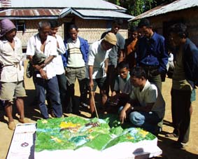
 Based on the activity report at ICIMOD, in addition to enhancement of natural resource management planning and livelihoods goals, staff envisaged that P3DM would assist in developing a process, which would be replicable for other Protected Areas. The objective was to ensure that plans developed by communities be included in larger management plans for Nokrek National Park and the buffer zone area. At that time, drafting and development of a buffer zone management plan was a high priority of the Forestry Department. However, initial efforts to draft such a plan paid limited attention to the actual resource management and utilization initiatives of the communities. The situation was due to lack of updated information on actual resource utilization and management activities. It was envisaged that, once more villages would have produced their P3DM, recommendations could be formulated on a workable policy for participatory buffer zone management and guidelines developed.
Recommended readings:
______ 2003. Participatory Community Mapping and Land Use Planning through 3D-modelling. Activity report. 6-16 May, 2003, Tura and Sasatgre, Meghalaya, India. ICIMOD, PAFID, NERCRMS
De Vera D. and Chalai K.M. 2007. 3-D Mapping: A Tool for Community Empowerment, in TIPS: Tools, Insights and Practices on Strengthening RPOs in Asia. Asian NGO Coalition for Agrarian Reform and Rural Development (ANGOC), Centre on Integrated Rural Development for Asia and the Pacific (CIRDAP), and International Fund for Agricultural Development (IFAD), pages 72-79
Follow us!