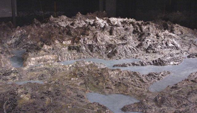
 Franz Ludwig Pfyffer von Wyher (1716-1802) constructed a relief model of an area of Central Switzerland between 1762 and 1786.
Its size is about 6,6 m x 3,9 m and it shows the Lake of Lucerne with Lucerne, Unterwalden, Zug and parts of the cantons Uri, Schwyz and Berne. The relief of Franz Ludwig Pfyffer is the oldest preserved large relief model of Switzerland.
At a scale of about 1:12’000 for the horizontal and 1:10’000 for the vertical direction it represents topographically an area of 4’100 km2 and as such about 1/10 of Switzerland. The model is constructed from pieces of timber, bricks, charcoal and cardboard with a mixture of gypsum, sand and beeswax as the top layer. Since 1873, this masterpiece is on display in the Gletschergarten Museum in Lucerne. The relief model of Franz Ludwig Pfyffer served as a basis for the several printed maps issued at the end of the 18th century.
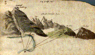
Pfyffer’s topographical sketch
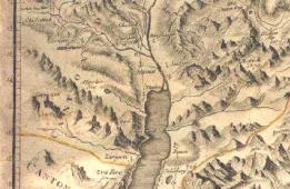 Clausner’s Map Jana Niederoest. 2002. 3D Reconstruction and Accuracy Analysis of Historical Relief Models. Institute of Geodesy and Photogrammetry Swiss Federal Institute of Technology ETH Hoenggerberg, CH-8093 Zurich, Switzerland.
Jana Niederöst. 2004. Image Analysis for the History of Cartography: Drawing Conclusions from the Evaluation of Pfyffer’s Relief. Institute of Geodesy and Photogrammetry, Swiss Federal Institute of Technology Zurich, Switzerland.
Follow us!